Northwest Launch Sites
Portland State Aerospace Society :
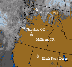
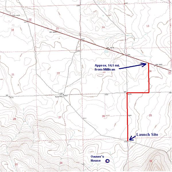
AESS/PSASLaunch site -Millican, Oregon (CLICK HERE). 15,200' MSL waiver.
AESS/PSASpayload integration site- Matt's house. (click here)29 foot MSL waiver.
AESS/PSASLaunch Simulation site- Brian's house. (click here)29 foot MSL waiver.
Other Regional Launch Sites :
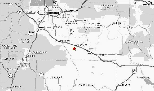
Brothers, Oregon - High desert in Central Oregon. Tripoli Oregon site. 16,000' waiver.
|
|
|
|
|
|
Map 1 |
Map 2 |
Map 3 (zoom) |
Orbital View |
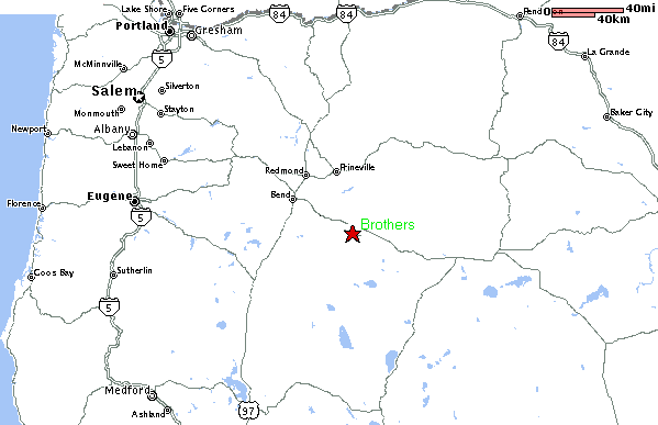
~200 Miles from Downtown Portland
Take Hwy 20 out of Bend towards Burns.
When you are @ 25 miles out you should see the small town of Millican.
Go approx. 14.1 miles farther east on Hwy20.
If you make it to the town of Brothers you've gone too far.
Turn right onto dirt road(look for launch signs). Follow for approx. 1 mile
There your are! (Please remember to close any gates behind you.
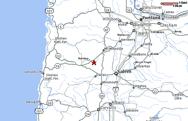
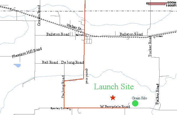
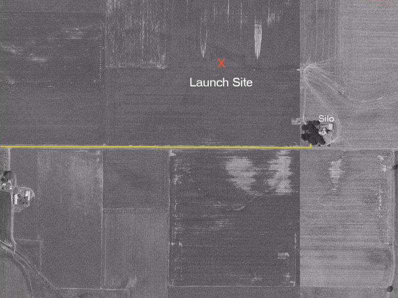
Sheridan, Oregon - Tripoli Oregon site. 5,000' waiver.
|
|
|
|
|
|
Map 1 |
Map 2 |
Map 3 (zoom) |
Orbital View |

55 Miles from Downtown Portland
From Portland take I-5 south to 99W. Head west on 99. It will turn into Hwy18 at McMinnville. Go Through McMinnville and head for Sheridan. Approx. 8 miles outside of McMinnville take a left on Christensen Rd. Take a left on Dejong Rd. Follow Dejong past the Ballston Store and Ballston Rd. The road soon turns to gravel. Follow this to Perrydale Rd and then take a left. Follow Perrydale Rd till you get to the grain silo on your left. Take a left and your there.
Monroe, WashingtonTripoli Puget Sound's Washington site. 4500' waiver.
|
|
|
|
|
Map 1 |
Map 2 |
Map 3 |
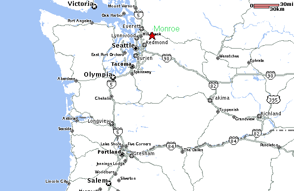
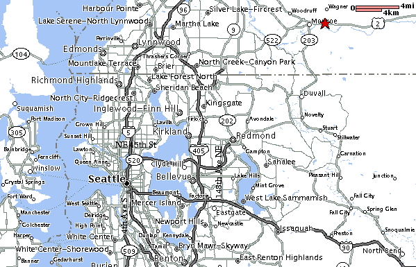

200 Miles from Downtown Portland
Assuming you are coming from Seattle/Bellevue, go north on I-405 and take the Woodinville exit onto State Route 522, the stay on 522 for approximately ten miles, until the road ends a US Highway 2. It ends with a 180 degree turn, and you'll want to turn left, eastbound, onto Highway 2. Pass on traffic light and turn right at the second, next to a Texaco mini-mart, on a road marked for Fall City; proceed through downtown Monroe and across the Snohomish River bridge. About 2 miles past the bridge you'll find a turn off to the right in a grove of poplars, marked with a big sign carrying lots of fine print for the Dept. of Corrections Honor Farm. Turn right, go through the the farm center, then turn left at the stop sign and proceed another quarter mile to a farm road turning sharply back on your left. Turn there and park off the main field along the fence - and you're there!
Black Rock Desert, NV105 miles north of Reno. National launch site. +50,000' waiver
(Click for Directions) Approximately 500 miles form Portland, OR
|
Calendar |
Launches |
|
|
|
Brothers, OR Sheridan, OR 16-17 Sep. Tindell 2K Monrow, WA 1st Sunday of evey month Black Rock Desert June 24-25 Mudroc 7.0 |
Choose site to veiw below. Monroe, WA WebCam (Bend) |
 Five Day Forcast